14+ OFFICIAL DATA SOURCES: EPA, FEMA, USDA, CENSUS, FHFA, HUD, NCES & USGS 3.95M+ Indexed Records • All 50 States + DC • Data as of November 02, 2026
Aerial drone view of residential neighborhood homes, river corridor, and city skyline
13-SECTION ALL-IN-ONE PROPERTY INTELLIGENCE • ALL 50 U.S. STATES

Instant Property Hazard, Flood, Soil, Valuation, Rent, School & Safety Reports

Screen any U.S. address across 14+ official federal & local registries in under a second: 3.23M EPA HazMat & Fuel Tanks, 18-Point NHD & Flood, USDA Soil & Tap Water, 20-Yr Home Appreciation & HUD 0–4 BR Rents, Schools, Fire/ISO, Walk Score & Census.

Try live examples:
LIVE SAMPLE DOSSIER PREVIEW
1200 Smith St, Houston, TX 77002
13 SECTIONS
VERIFIED
🛡️ EPA HazMat & 18-Pt NHD 598 Sites • 18 Zones
📈 5-Yr Home Appreciation (FHFA) +30.7% (+53.8% 10-Yr)
🏠 HUD 2-BR Fair Market Rent $2,360/mo • IRS QOZ ✓
🎓 Nearby Schools & Fire/ISO 185 Schools • Fire 0.44 mi
🚶 EPA Walkability & Rail 16.2 / 20.0 • Rail 0.25 mi
Inspect Full Unredacted Sample + PDF →
Compiled From Official Data:
U.S. EPA (ECHO / RCRA / SDWIS) FEMA NFHL & 18 NRI Perils U.S. Census Bureau (ACS) FHFA HPI • HUD SAFMR • IRS QOZ USDA Soil • NCES • USGS • USDOT
Updated November 02, 2026
✓ 860 RECORDS • 13 SECTIONS READY

1200 SMITH ST, HOUSTON, TX 77002

Rooftop Verified: (29.75753, -95.36966) • 1.0-Mi Radius
Resolved via U.S. Census Parcel Geocoder

Your complete 13-section property intelligence, hazard, market & neighborhood dossier is compiled from 14+ official databases (EPA, FEMA, USDA, USGS, Census, FHFA, HUD, NCES & USDOT):

✓ 598 EPA Regulated Sites in Radius (Names, Distances, Bearing & Fines)
✓ 18-Point NHD & 18 FEMA Climate Perils (Flood, Wildfire, Faults, Radon, Pipelines)
✓ USDA Soil Horizon & 16 Tap Water Systems (Shrink-Swell, Corrosion, Lead & PFAS)
✓ FHFA 20-Yr Home Appreciation & HUD 0–4 BR Rents (Gross Yield & IRS Opportunity Zone)
✓ U.S. Census Neighborhood Demographics (Income, Home Value, Education & Commute)
✓ 114 Nearby Schools & Colleges (Public, Charter & Private K–12 Ratios & Grades)
✓ 62 Fire/EMS, Hospital & Police Stations (ISO Tier, Walk Score, Rail & Flight Noise)
✓ Official A–F Risk Grade, Owner/APN & County Safety (Executive Pass/Fail Verdict)
See All 13 Sections Before You Buy
Preview a complete, unredacted 13-section certified dossier (interactive web + multi-page PDF) to see every hazard, market, school, and safety table included:
📄 Open Full 13-Section Sample Report →
INSTANT 13-SECTION DOSSIER + PDF View Sample Dossier →

Select Your Report Package to Unlock Full Results

Instant browser access + downloadable multi-page PDF covering all 13 Environmental, Market, School, Emergency & Neighborhood sections.

🛡️ EPA & 18-Pt NHD 🌊 Flood, Soil & Water 📈 Home HPI, Rent & QOZ 🎓 Schools & Colleges 🚒 Fire/ISO, Walk & Transit 📊 Census, Safety & APN
🔒 256-Bit SSL Checkout (PayPal / Visa / Mastercard / Amex) ✓ 100% 7-Day Satisfaction Guarantee Open Sample Report →
WHAT YOU GET INSIDE EVERY REPORT

Complete 13-Section Property Intelligence & Due-Diligence Contents

Every address dossier unites environmental engineering, natural hazards, real estate valuation, rental comps, schools, emergency response, and neighborhood demographics.

Inspect Live 13-Section Sample →
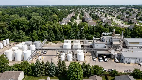
Industrial chemical storage tanks and manufacturing facility near residential neighborhood tree line
SECTIONS 1 – 4
Industrial HazMat, 18-Pt NHD & Title/APN

Screen 3.23M EPA Superfund, RCRA hazardous waste, TRI chemical plants & underground fuel tanks with exact distance in feet, compass bearing, and federal fines.

✓ Official A–F Executive Pass/Fail Grade ✓ 18-Point NHD Statutory-Style Checklist ✓ County Assessor Owner, APN & Sale Log
Suburban single-family houses bordering winding river floodplain and green embankment
SECTIONS 5 – 8
Floodplain, 18 Perils, Soil & Tap Water

Detect hidden flood insurance zones, expansive clay foundation movement, buried pipe corrosion, radon gas zones, and municipal tap water violations before closing.

✓ FEMA SFHA Flood + All 18 Climate Perils ✓ USDA Soil Shrink-Swell & Water Table ✓ EPA SDWIS Tap Water, Lead & PFAS
Attractive brick single-family suburban homes with manicured lawns and driveways
SECTIONS 9 – 10 • NEW
Home Appreciation, Rent Comps & Census

Benchmark 1-to-20-year FHFA repeat-sales home appreciation, HUD 0–4 bedroom Fair Market Rents, implied rental yield, and Census socioeconomic profiles.

✓ FHFA Tract, ZIP, County & State HPI ✓ HUD FY2026 0–4 BR Rents & Gross Yield ✓ IRS Opportunity Zone & Census DP02–DP05
Modern community brick school entrance, walkable crosswalk, and commuter light-rail transit station
SECTIONS 11 – 13 • NEW
Schools, Fire/ISO, Walk Score & Safety

Evaluate nearby public, charter & private K–12 schools and colleges, fire-station insurance distance, hospital proximity, transit access, and county safety baselines.

✓ NCES Grades, Enrollment & Teacher Ratios ✓ Fire/EMS ISO Proxy, Hospitals & Police ✓ EPA Walk Score (/20), Rail, Flight & Safety
INTERACTIVE REPORT WALKTHROUGH

Preview Real Data Tables Included Inside Your Dossier

Download Sample PDF →
Sample Screening Layer Parcel Determination Distance / Buffer Primary Source
EPA Superfund (NPL) & Active Enforcement SCREENED (0 NPL IN 0.25 MI) 0.125 – 2.0 Mile Rings U.S. EPA ECHO / SEMS
RCRA Hazardous Waste & Underground Tanks 119 RCRA • 33 UST SITES Compass Bearing + Feet U.S. EPA RCRAInfo / FRS
18-Point NHD Statutory-Style Checklist 18 ZONES EVALUATED IN / NOT IN / ADVISORY FEMA • USGS • USFWS • USDOT
BUILT FOR EVERY REAL ESTATE DECISION

Institutional Property Due Diligence Without the $2,500 Wait

Trusted workflow for homebuyers, real estate investors, landlords, and licensed agents across all 50 states.

FOR HOMEBUYERS & FAMILIES

Uncover Hidden Risks Before You Waive Contingencies

Seller disclosures rarely mention nearby leaking fuel tanks, expansive clay soil slab movement, PFAS tap water advisories, flight-path noise, or insurance-raising fire station distances.

Screen a Home Address ($14.95) →
FOR INVESTORS & LANDLORDS

Underwrite Appreciation, Rent Comps, QOZ & Liability

Evaluate 20-year FHFA appreciation, HUD 0–4 BR Fair Market Rents, gross yield, IRS Opportunity Zone tax status, Census income/vacancy trends, and environmental liability in seconds.

Inspect Sample Investor Dossier →
FOR AGENTS, BROKERS & INSPECTORS

White-Label Branded Client PDFs for $1.96/Report

Stand out at listing presentations and buyer consultations with 25 full 3.0-mile 13-section dossiers featuring your custom name, brokerage, and license number on every PDF cover.

Explore 25-Report Agent Pass ($49) →

Major U.S. Municipal Environmental Screening Hubs

Explore city-level EPA violation rates, RCRA hazardous waste density, and high-risk industrial corridors.

Browse All 50 States →
Houston, TX 202 High Risk
14,830 EPA sites • 5,730 RCRA waste
Seattle, WA 124 High Risk
4,174 EPA sites • 3,408 RCRA waste
Baton Rouge, LA 113 High Risk
5,170 EPA sites • 2,152 RCRA waste
Philadelphia, PA 107 High Risk
4,521 EPA sites • 2,909 RCRA waste
Portland, OR 105 High Risk
4,025 EPA sites • 3,071 RCRA waste
Atlanta, GA 99 High Risk
5,981 EPA sites • 1,802 RCRA waste
Baltimore, MD 88 High Risk
5,327 EPA sites • 2,873 RCRA waste
Houma, LA 87 High Risk
1,465 EPA sites • 637 RCRA waste
Lafayette, LA 84 High Risk
2,212 EPA sites • 1,070 RCRA waste
Tacoma, WA 84 High Risk
1,961 EPA sites • 1,371 RCRA waste
Albuquerque, NM 82 High Risk
5,124 EPA sites • 1,732 RCRA waste
Hammond, LA 80 High Risk
843 EPA sites • 256 RCRA waste

Browse Environmental Records by State

Select any state to inspect county radon zones, municipal directories, ZIP code rankings, and facility compliance dossiers.

California
690,395 sites
1,798 High
Georgia
173,651 sites
1,218 High
Texas
171,922 sites
2,788 High
Florida
167,739 sites
1,108 High
New York
160,771 sites
1,764 High
Illinois
108,346 sites
1,407 High
Pennsylvania
100,493 sites
2,668 High
Colorado
79,903 sites
1,092 High
New Jersey
74,024 sites
1,335 High
Louisiana
73,535 sites
2,867 High
Minnesota
73,113 sites
332 High
North Carolina
67,486 sites
1,157 High
Michigan
66,179 sites
817 High
Ohio
63,767 sites
1,114 High
Missouri
61,886 sites
926 High
Indiana
58,392 sites
862 High
Alabama
58,197 sites
715 High
Wisconsin
57,405 sites
329 High
Massachusetts
51,634 sites
671 High
Virginia
49,239 sites
727 High
Utah
48,794 sites
192 High
Tennessee
48,290 sites
837 High
Washington
46,871 sites
2,436 High
West Virginia
46,428 sites
1,874 High
Kansas
43,175 sites
293 High
Kentucky
40,645 sites
909 High
Maryland
38,693 sites
709 High
South Carolina
36,650 sites
514 High
Oklahoma
35,672 sites
533 High
New Hampshire
28,415 sites
154 High
New Mexico
27,991 sites
628 High
Connecticut
25,161 sites
357 High
Oregon
25,125 sites
809 High
Arizona
24,390 sites
211 High
Iowa
22,726 sites
373 High
Arkansas
22,418 sites
691 High
Montana
21,414 sites
152 High
Idaho
17,223 sites
324 High
Mississippi
16,751 sites
419 High
Alaska
15,535 sites
315 High
Nebraska
14,570 sites
179 High
Maine
13,137 sites
134 High
Vermont
13,093 sites
105 High
Nevada
12,536 sites
127 High
North Dakota
11,916 sites
136 High
Wyoming
11,290 sites
146 High
Rhode Island
10,283 sites
105 High
Puerto Rico
10,139 sites
343 High
Hawaii
9,918 sites
109 High
South Dakota
8,668 sites
57 High
Delaware
4,343 sites
74 High
District of Columbia
3,950 sites
75 High

Homebuyer & Investor Property Due Diligence Guides

Learn how to interpret Superfund buffers, HUD Fair Market Rents, FHFA appreciation, fire/ISO classes, soil shrink-swell, and FEMA flood zones.

View All 20 Guides →
Soil & Foundation Engineering • 7 min read

USDA Soil Test by Address: How to Check Expansive Clay, Foundation Shrink-Swell & Water Table Depth

Learn how to check any U.S. property address against USDA NRCS SSURGO soil engineering surveys for expansive clay (Linear Extensibility LEP %), foundation slab cracking risk, shallow water tables, and underground pipe corrosion.

Read Guide →
Drinking Water & PFAS • 6 min read

Tap Water Quality & PFAS Check by Address: How to Screen EPA SDWIS Water Violations Before Buying

How to screen any home or land parcel for EPA Safe Drinking Water Information System (SDWIS) utility violations, Clean Water Act 303(d) impaired water bodies, NPDES industrial dischargers, and PFAS forever-chemical sources.

Read Guide →
Geologic & Sinkhole Risk • 6 min read

Sinkhole Risk Map by Address: How to Check Karst Bedrock & Ground Subsidence Before Closing

Buying in Florida, Tennessee, Pennsylvania, Missouri, Kentucky, Texas, or Virginia? Learn how carbonate limestone and dolostone karst geology creates sinkhole hazards and how to screen any address.

Read Guide →
Natural Hazard Disclosure • 7 min read

18-Point Natural Hazard Disclosure (NHD) Report: Flood, Wildfire, Seismic Faults, Pipelines & Termites

Why wait 10 days and pay $99–$135 for a California-style Natural Hazard Disclosure (NHD) report? Screen all 18 natural, supplemental, and infrastructure hazards nationwide in seconds.

Read Guide →
Homebuyer Due Diligence • 6 min read

How to Check If a House or Property Is Near a Superfund or Hazardous Waste Site

Step-by-step guide to screening any U.S. street address for nearby EPA Superfund (NPL) sites, RCRA hazardous waste generators, and active environmental violations within a 1-mile radius before you close.

Read Guide →
Buyer's Checklist • 7 min read

Environmental Report Before Buying a House: Complete Buyer's Checklist

What every homebuyer should verify during the inspection contingency period: EPA violation history, leaking fuel tanks, dry cleaner solvents, FEMA flood hazard zones, and county radon potential.

Read Guide →
VERIFIED PUBLIC RECORD METHODOLOGY

Frequently Asked Questions About 13-Section Property Reports

2026 National Hazard Rankings → Full Scoring Methodology →
What does a 13-Section Complete Property Intelligence & Hazard Report check?

Our 13-section dossier screens 3,230,651 U.S. EPA-regulated facilities, an 18-point Natural Hazard Disclosure (NHD) checklist, FEMA flood & 18 climate perils, USDA soil shrink-swell & pipe corrosion, SDWIS tap water & PFAS, FHFA 20-year home appreciation, HUD 0–4 BR Fair Market Rents, IRS Opportunity Zones, U.S. Census demographics, NCES public/private schools & colleges, fire/ISO protection, EPA walkability, transit/flight noise, and county public safety.

How do I check if a property is in a FEMA Flood Zone or has expansive clay soil foundation problems?

Enter any U.S. street address or ZIP code into the search bar to screen FEMA National Flood Hazard Layer (Zone AE, VE, A, or X), 25-year county FEMA disaster declarations, and USDA SSURGO soil engineering metrics including Linear Extensibility (LEP %), shrink-swell clay risk, water table depth, and pipe corrosivity.

Does this report check tap water quality (SDWIS), PFAS contamination, and radon or sinkhole risk?

Yes. Every report screens EPA Safe Drinking Water Information System (SDWIS) public water utilities, Clean Water Act NPDES permits, Section 303(d) impaired water bodies, PFAS industrial proximity indicators, EPA Radon Zones (Zones 1, 2, and 3), and USGS karst sinkhole bedrock formations.

How is the 0–100 Facility Risk Score calculated?

Every facility is scored on a strict 5–100 scale based on active Significant Non-Compliance (SNC) flags, quarters in violation over the past 3 years, formal federal enforcement actions, monetary penalties, and hazardous waste or toxic release classifications.

Is FullPropertyReport affiliated with the U.S. EPA, USDA, or FEMA?

No. FullPropertyReport.com is an independent property due-diligence platform that compiles and analyzes public federal records from the U.S. EPA, USDA NRCS, USGS, FHFA, HUD, NCES, U.S. Census Bureau, and FEMA.

13-Section Property & Market Dossier
From $14.95 • 7-Day Guarantee
Sample Screen Address